Puerto Carreño
Puerto Carreño
Vichada’s capital, where rivers and local connections deserve time of their own.
VICHADA NETWORK · INDEPENDENT REFERENCE
Explore the Route 95 corridor, Casuarito and Vía de la Dignidad: historical map, El Tuparro connections and practical research for an adventure planned by segment.
DOCUMENTARY GUIDE · REVIEWED NOVEMBER 12, 2026
This corridor invites you to understand a landscape where road and river travel complement each other. Spend time in Puerto Carreño, get to know Casuarito, and investigate a journey toward the Orinoco landscapes and El Tuparro. Build the trip around your interests and the conditions of each segment.
We use “National Route 95” as a historical reference to the corridor shown on the map. The sources reviewed do not confirm a continuous, passable national highway from Puerto Carreño to Inírida. The departmental plan uses other codes for existing roads.
Vichada Network director Col. David J. Wright reports November 15–May 31 as the window when the riverside corridor is generally more accessible and practical for walking, cycling, motorcycles or ATVs. His local account describes journeys commonly taking several days. Actual duration depends on the segment and mode; walking and motorized travel require different schedules.
This local account, supplied November 12, 2026, is not an official opening declaration or a road-condition report. Park sources distinguish dry-season access and river alternatives without confirming this exact interval for every segment. Check recent rain, terrain, crossings, access and return arrangements. Do not automatically extend this window to projected alignments toward Inírida.
The network currently has no confirmed fat-tire e-bike rental service. Developing that option is intended, but no opening date, fleet or bookings are announced. With your own e-bike, verify loaded range, charging and power access rather than assuming recharging or vehicle carriage.
Bicycle Touring · Motorcycles and ATVs · Camping and Multi-Day Journeys
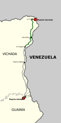
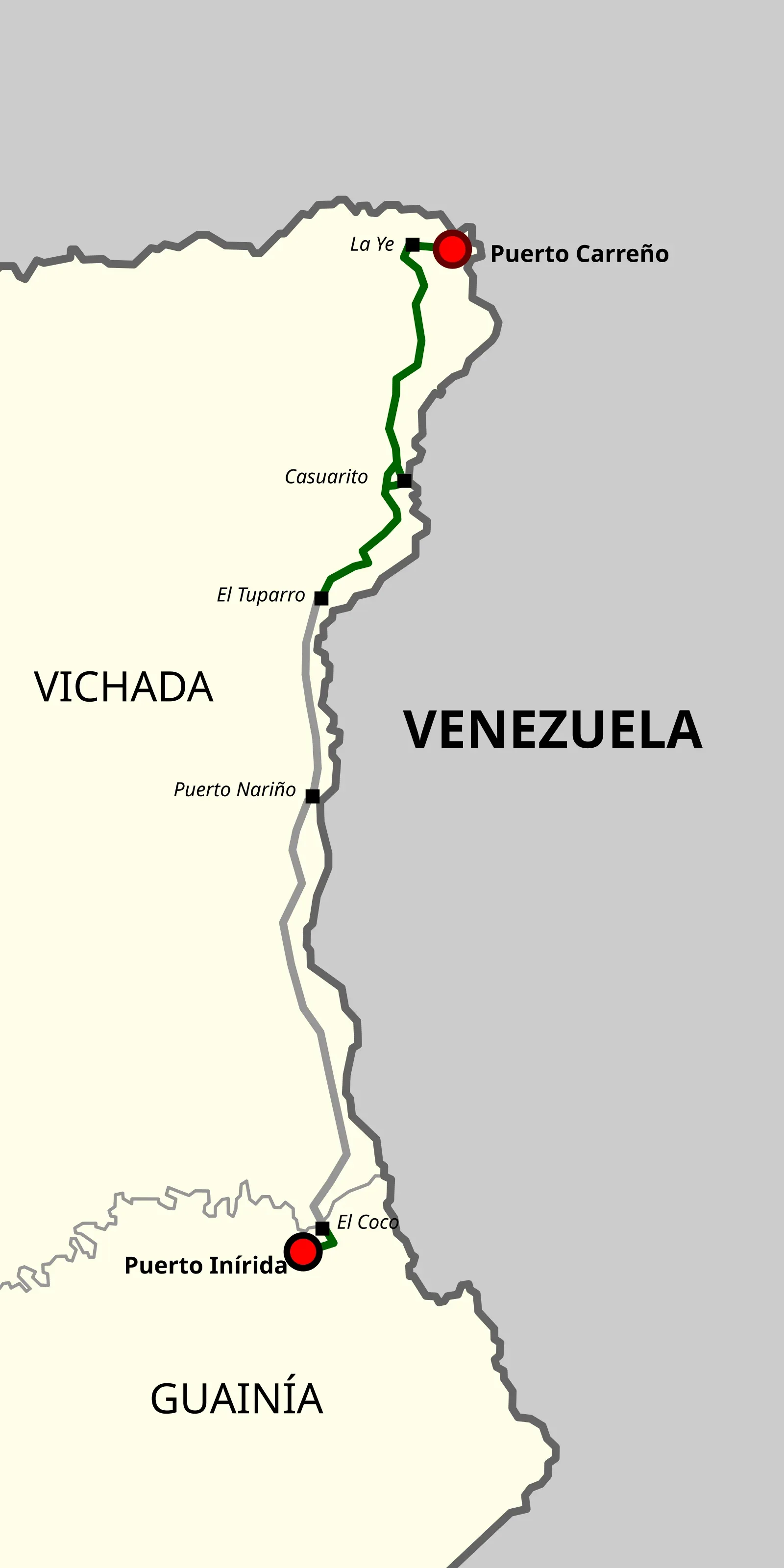
Nemequene published this reference map in 2021. We retain its original alignment and labels and provide WebP renditions for the web. It is an orientation map, not a navigation chart or road-condition report.
The “El Tuparro” label does not establish an authorized park entrance. “Puerto Nariño” here refers to the settlement in Cumaribo, Vichada, rather than the municipality of the same name in Amazonas.
| Segment or Connection | Documented Context | Planning the Journey |
|---|---|---|
| Puerto Carreño and La Ye | Starting point and connection with the eastern corridor. | Choose the actual departure point, vehicle, driver and return plan. Distinguish the Route 40 approach from any proposed through-road to Inírida. |
| Casuarito | Road connection and Orinoco river port within Puerto Carreño municipality. | Check the road and Paso Dagua crossing. Supertransporte’s 2020–2022 inspections recorded a community ferry there. Its present operation needs confirmation. |
| Garcitas and the El Tuparro Connection | A possible combination of road and river transport. | The park’s historical access guide describes a boat transfer at Garcitas. Ask the park about the currently authorized access and onward connection. |
| La Ye–Puerto Nariño, Cumaribo | The 2018–2027 road plan identifies Vía de la Dignidad as 40VC03. | The inventory lists 191.3 km for that segment. This is a planning reference prepared in 2017, not a measurement of your complete trip or a current road report. |
| Puerto Nariño–Inírida | The map includes projected alignments. Inírida is in Guainía department. | A continuous road connection has not been verified here. An extension toward Inírida needs its own transport, transfer, host and access research. |
Documentary basis: the 2018–2027 departmental road plan, tables 19–21 and diagnosis, Supertransporte 2022, and park access guidance. Present-day conditions need a separate check.
Start with an outing whose return you can arrange. A first investigation can focus on Puerto Carreño and Casuarito: learn the boarding points and compare road and river options. If you combine them, establish who will carry the people, vehicle and luggage. A passenger ticket does not automatically include a motorcycle or bicycle.
Motorcyclists, cyclists and four-wheel-drive travelers can investigate segments suited to their experience using recent local information. Choose the segment before the vehicle. Ask when someone last traveled it and what conditions they encountered. A line in a mapping app does not establish the condition of a crossing.
You can arrange a driver, boat pilot or local interpreter for a particular segment while making your own itinerary decisions. If an Indigenous contributor wishes to accompany you, agree on the role, language and payment. Landowners and community authorities decide access to their territories. Vehicle rental services for this route have not been confirmed.
The parks authority distinguishes dry-season road access from river alternatives. Invías’ 2024 prioritized-visits list includes Casuarito–Paso Dagua and sections of the Casuarito road. These are access and planning references. They do not establish completed works or a crossing’s operation today.
Before departure, arrange fuel, water, sun and rain protection, tire repairs, communication and a contact who knows your plan. Confirm crossing capacity and hours, overnight options if delayed, and a turnaround point. Establish trip duration from the vehicle, road and water conditions.
An April 2026 ACAPS report describes protection risks and mobility restrictions in border corridors, including Casuarito. This is regional analysis rather than a daily report for this road. Check present conditions with authorities and local contacts before committing to a remote journey.
Reaching the park area and entering the park require separate arrangements. The official page requires an approved guide or interpreter and asks visitors to confirm capacity and dates before paying. Confirm the entry point and any transfers with the park. An extension toward Inírida or a crossing to Venezuela needs its own access and documentation arrangements.
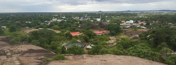
Puerto Carreño
Vichada’s capital, where rivers and local connections deserve time of their own.
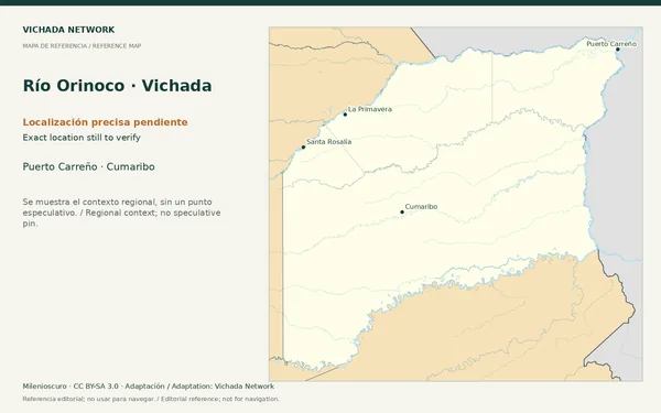
Puerto Carreño · Cumaribo
A major waterway connecting landscapes while also marking an international border.
Cumaribo · La Primavera
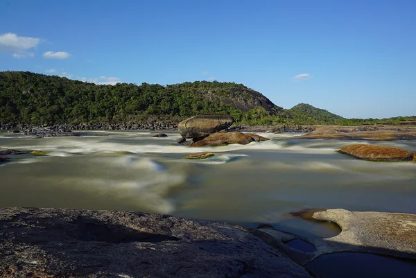
Rapids, open savannas and ancient rock outcrops: a landscape best understood with people who know it.